Measuring the UK: The Role of Trigonometry in Mapping
Written on
Chapter 1: Introduction to Trigpoints
Before the advent of GPS technology, the geography of Great Britain was meticulously measured using mathematics.
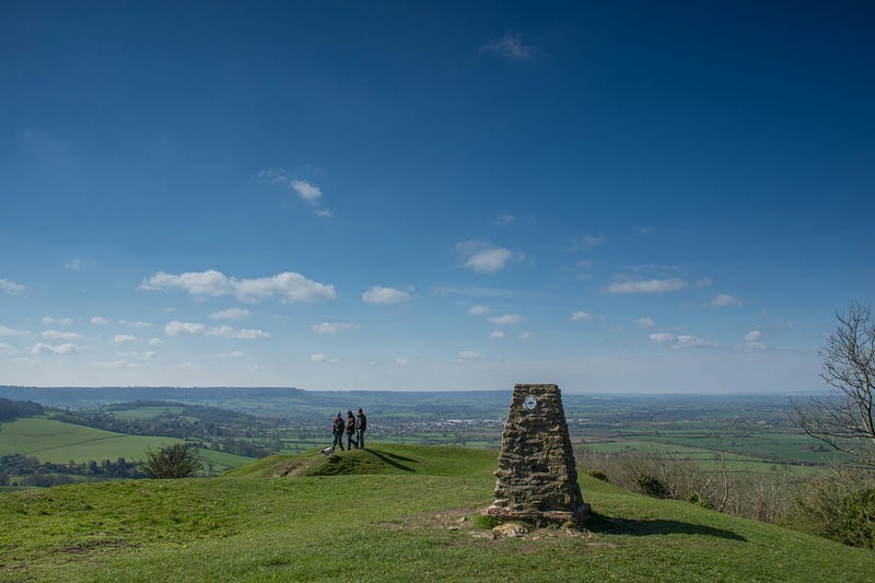
In both the UK and Ireland, short stone pillars can be found on various hills, some of which are located near my residence. While they may appear charming, they can also seem somewhat out of place. But what purpose do they serve?
In 1936, an initiative was launched to accurately define the size and shape of the UK. Concrete markers, known as trigpoints, were strategically placed at the highest locations in each region, allowing for clear visibility between neighboring points.
With the trigpoints established, the next step involved applying basic trigonometry. The innovative aspect was the decision to utilize this mathematical approach in the first instance.
Section 1.1: Visualizing the Trigpoints
Imagine the trigpoints positioned in a certain arrangement:

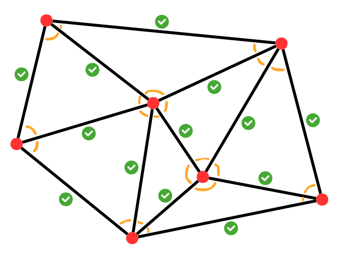
The angles formed by the lines connecting these points are measured, resulting in a network of triangles with defined angles:
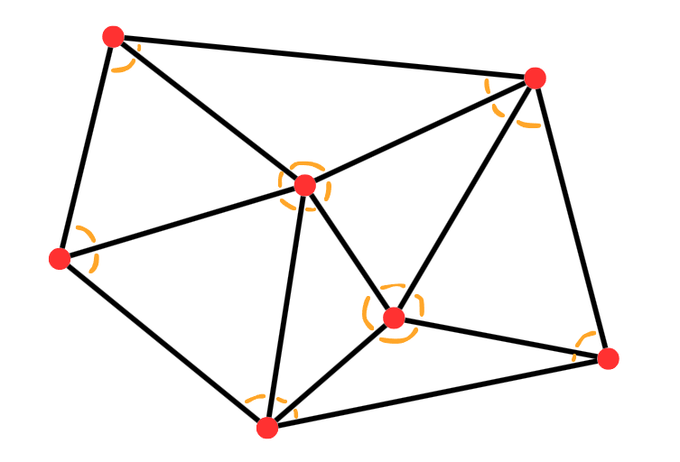
These triangles spanned across the UK. The angles were measured using a theodolite—a telescope mounted on a protractor. An individual would position themselves at one trigpoint, align the theodolite with another, and record the angle. The process would be repeated for a third trigpoint, leading to the documentation of the angle differences, represented as the orange angles in our earlier diagram.
Now, with all angles identified, the task was to measure the distance between a single pair of trigpoints. This singular measurement was sufficient to compute the remaining distances using trigonometry.
Section 1.2: Applying the Sine Rule
To understand how this works, let's focus on the triangles and the rules required to calculate side lengths from known dimensions. The sine rule states:
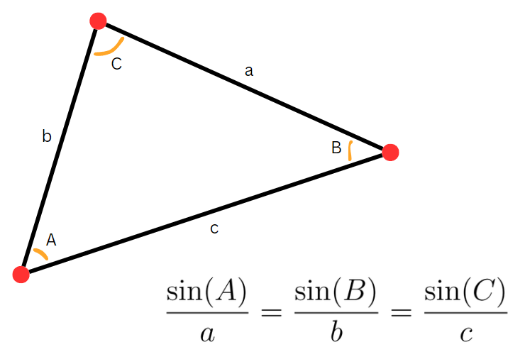
If all three angles A, B, and C are known, knowing just one side length allows for the calculation of the other two sides!
Here's a practical example with calculations:
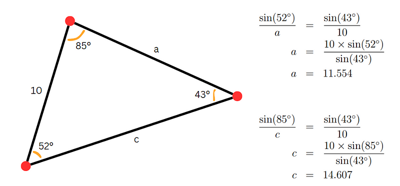
This method was then applied to each triangle in the net covering the UK. Since all triangles are interconnected, solving one provides a known side length for others.
Returning to the year 1936, the last step was to measure the distance between one pair of trigpoints. Remarkably, this measurement had already been performed in 1784, using glass rods laid across Hounslow Heath!
With this foundational measurement complete, subsequent calculations could be executed with pen and paper. Using additional triangle rules, straight-line distances between locations could be calculated, along with the areas required to determine the total landmass of the UK.
After all calculations were concluded, the UK was mapped with an impressive accuracy of 20 meters! This achievement is remarkable, especially considering that the people of 1936 could not have predicted the technological advancements we have today. Nonetheless, they persevered and succeeded in their endeavor!
To further explore the topic of British measurements, check out this video titled "British measurements: pints, feet, Celsius, and more!" which delves into the unique measurement systems used in the UK.
Chapter 2: The Challenges of Mathematical Education
In addition, this video "Why the UK has a problem with maths | FT Film" discusses contemporary challenges in mathematical education within the UK.